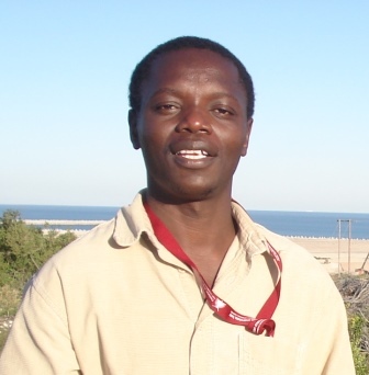
| Position: | Lecturer | 
|
| Qualifications: | B.Envi.St. (Hons) BSc. (Hons) MPhil. PhD |
| Office Block: | Room 8B Science Building PMB Campus |
| Telephone: Fax: | +27 (0) 31 260 5539 +27 (0) 31 260 5344 |
| Email: | Odindi@ukzn.ac.za |
Currently teaching/courses
Environmental Systems (ENVS120)
Introduction to GIS (ENVS211)
Introduction to Remote Sensing (ENVS250)
Research Methods (ENVS700)
Research interest
- Land use land cover mapping
- Vegetation remote sensing
- Remote sensing of urban landscapes and climate change
SELECTED CONFERENCE PRESENTATIONS
-
October 2012: Mhangara, P. & Odindi, J. O – “Potential of texture-based classification in urban landscapes using multispectral aerial photographs”9th International Conference of African Association of Remote Sesnsing and the Environment (AARSE 2012), El Jadida, Morocco, Oct 29- Nov 2, 2012.
2 October 2012: Mhangara, P. & Odindi, J. O – “Potential of texture-based classification in urban landscapes using multispectral aerial photographs; evaluating the potential in East London, South Africa (Poster presentation)” 9th International Conference of African Association of Remote Sensing and the Environment (AARSE 2012), El Jadida, Morocco, Oct 29- Nov 2, 2012.
3 Sept 2012: P. Mhangara and J. Odindi – “Object based urban classification using Sumbandilasat
Imagery” 1st SA-Geo (2012) Symposium, Using Earth Observations for Societal benefits in South Africa, 11 -12 Sept 2012, Cape Town
4 Sept 2012: P. Mhangara and J. Odindi (2012). “Agricultural field boundary extraction using
object based classification” 1st SA-Geo (2012) Symposium, Using Earth Observations for Societal
benefits in South Africa, 11 -12 Sept 2012, Cape Town
5 April 2012: P. Mhangara and J. Odindi 2012. “Object Based Land Use and Land Cover Classification Using SumbandilaSat Imagery in Pretoria, South” European Space Agency-Sentinel-2 Preparatory Symposium. April 23-27, Frascati (Rome), Italy.
6 November 2011, Odindi, J.– Respondent to the session “Political economy of climate change” Idasa Conference: Africans dealing with climate change: Citizens approach to COP17. 28-29th Nov Diakonia Centre, Durban, South.
7 May/June 2011, Mhangara, P., Odindi, J. O., Kleyn, L. and Remas, H.: Paper presented at 2011 AfricaGEO Conference, Cape Town South Africa “Road extraction using object oriented classification”.
8. May/June 2011, Mhangara, P., Odindi, J. O., Kleyn, L and Remas, H May/June: Paper presented at 2011 AfricaGEO Conference, Cape Town South Africa. “Mapping urban areas using object oriented classification”.
9. Sept. 2008: Paper presented at the Biennial conference of Society of Southern African Geomorphologists held in Pretoria. “A comparative assessment of soil dynamics under unaltered vegetation cover conditions: Implications for landscape functionality”.
10 Oct. 2008: Paper presented at the Seventh African Association of Remote Sensing of the Environment Conference (AARSE) held in Accra, Ghana. Paper title “Determination of Pteronia incana spectral trends using laboratory and field spectroscopy”.
11 Jul. 2007: Paper presented at the Seventh Society of South African Geographers Conference held in Port Elizabeth. “Application of multi-temporal High Resolution Imagery (HRI) in separating Pteronia incana invaded areas using Perpendicular Vegetation Index (PVI) and Spectral Mixture Analysis (SMA)”.
12 Sept. 2006: Paper presented at the Society for South Africa Geographers held at the University of Kwa-Zulu Natal. “The use of high resolution multi-temporal colour infra-red imagery in plant invaded surface separation in the lower Great Fish Region”.
13 Sept. 2005: - Paper presentation at the South African Annual Students Geography Conference held at the University of the Western Cape. “Temporal and moisture implication on Blue Bush in invasion using Remote Sensing imagery”.
Publications
to view Dr Odindi's publications